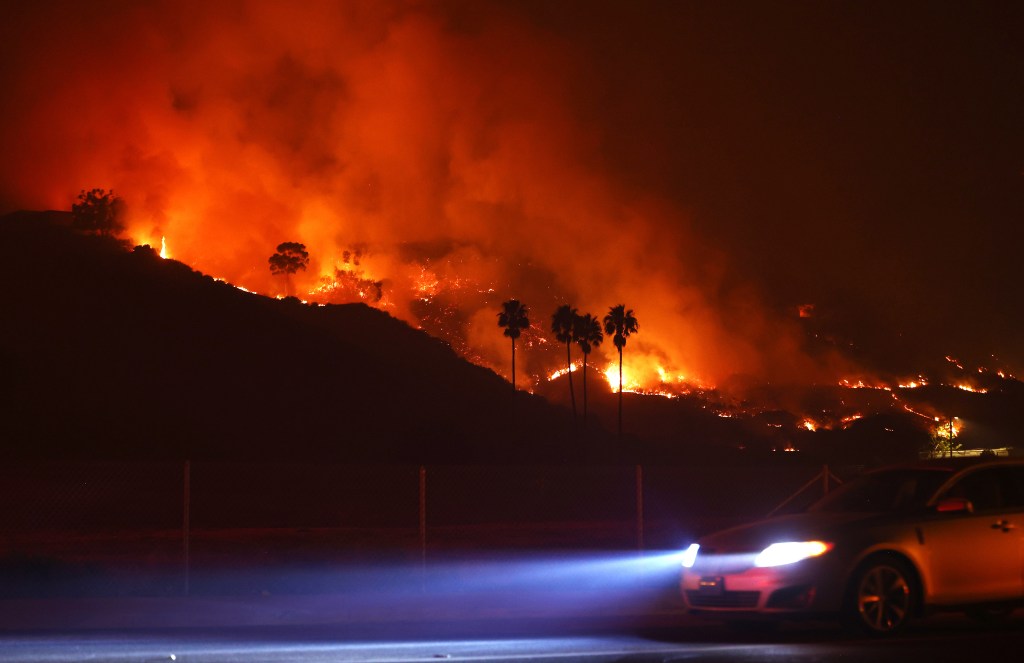
UPDATED 8 am: A fast-moving wildfire driven by strong Santa Ana winds that broke out late Monday in Malibu has exploded to 2,200 acres with no containment.
Mandatory evacuation orders remain in place east of Malibu Canyon Road and south of Piuma Road, along with the Serra Retreat area, fire officials said in a post to X. Malibu city officials extended mandatory evacuation orders at 2:36 a.m. from Tuna Canyon to Puerco Canyon, with an evacuation warning for Puerco Canyon to Trancas Canyon.
A shelter in place order remains in effect for Pepperdine University students. Classes have been canceled, along with final exams, and power outages have been reported at the campus. Malibu city schools also have been canceled for the day.
The National Weather Service issued a Red Flag Warning for areas of Los Angeles and Ventura Counties as warm, dry Santa Ana winds produced gusts up to 80 mph.
An unknown number of homes and structures have been destroyed or damaged, but the extent of damage is not yet known. Some 2,000 structures are threatened, according to Fox11.
The cause of the fire remains under investigation.
City News Service contributed to this report.
This story is developing and we will continue to update.
PREVIOUS, 1:14 AM Tuesday: A fire was sparked shortly before midnight tonight off Malibu Canyon Road just east of Pepperdine in Malibu. The blaze quickly erupted to 100-plus acres in minutes, driven by wind gusts up to 50 mph on hilltops and in canyons.
Local TV news quickly picked up the story, cutting into regular programming and broadcasting arresting images of the blaze.
While Pepperdine students are sheltering in place as the fire seems to be holding east of Malibu Canyon Road, much of central Malibu, Surfrider Beach and the famed Malibu Colony are under evacuation orders. The order covers the area east of Malibu Canyon Road and south of Piuma Road, as well as around the Serra Retreat. Portions of PCH, Malibu Canyon and Mullholland Highway were closed, according to KTLA5.
The area in red on the map above is under a mandatory evacuation order. An evacuation order has been issued for the yellow area, per Los Angeles County’s emergency web site.
The fire has been dubbed The Franklin Fire.
The incident likely brings back tough memories for many in the evacuation area, as the Woolsey Fire in 2019 ripped through 97,000 acres in Malibu and destroyed 1600 structures. Many residents are still rebuilding.
Forecasters said the peak of the current “particularly dangerous situation red flag warning” could see winds of 25 to 40 mph, gusting to 65 mph in typically wind-prone areas.
“Some of the windier foothills and mountains will likely see wind speeds of 30 to 50 mph with damaging wind gusts in the 60 to 80 mph range during the peak of the event (Monday night) into Tuesday,” according to the NWS. “Some of the highest wind areas will likely be the San Gabriels, Santa Susanas, western Santa Monicas into Malibu, Ventura county valleys (especially Simi Valley and Moorpark), and western San Fernando Valley (especially Highway 118/210 corridors from Porter Ranch to San Fernando).”
Humidity levels, meanwhile, could fall to as low as 5% in some areas, “with isolated readings as low as 2% likely,” forecasters said.
As is typical during red flag conditions, Southern California Edison advised thousands of customers that they could be subject to power cuts designed to prevent electrical equipment from sparking wildfires during threatening winds.
Due to the Santa Ana winds and critical fire danger conditions, Caltrans and the California Highway Patrol closed Topanga Canyon Boulevard between Mulholland Drive and Pacific Coast Highway in the Santa Monica Mountains at noon on Monday. The closure was expected to continue 6 p.m. Wednesday. Authorities say only residents and local business traffic will be allowed into the canyon.
City News Service contributed to this report.
